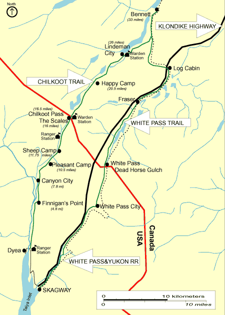
Chilkoot Trail Map

Chilkoot Trail Map
The most challenging way to follow in the footsteps of the stampeders is by hiking the 33-mile-long Chilkoot Trail, accessible only on foot. It is a difficult hike and usually takes three to five days. The trail begins at the Taiya River bridge near the Dyea townsite and travels over the Chilkoot Pass to Lake Bennett.

Click below to see pictures of the Chilkoot Trail

Bennett Train Loaded With Hiker's Backpacks

Bennett Train Station

Cooking at Bare Loon Camp

Canyon City Campground

Finnegans Camp

Happy Camp

Chilkoot Pass

Old Boat Frame-Lindeman City

Sheep Camp

Chilkoot Trail Sign

Chilkoot Elevation Map

Whitepass Train


Be sure to check Parks Canada Chilkoot Trail online.
http://parkscan.harbour.com/ct/

For more information on Parks Canada fees and reservations call 867-667-3910 or toll free 1-800-661-0486
( Canada and US mainland).


Footer Graphic

Home Page | Photography | Travel Guide | QT Video |
Featured Trips | Maps | History | Getting To Alaska | Guest Book | Links | Submit Photos | Advertise | Contact us


Copyright © 1999 - 2001 Alaska Photography & Travel Guide, All Rights Reserved.
Web Design By:
Sundog Media